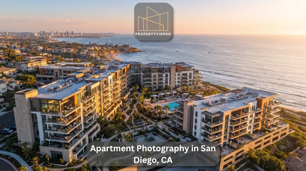
A large apartment community is not a single building; it is a small landscape with its own geography. Multiple structures, courtyards threaded between them, a pool deck here, a parking structure there, green space, walking paths, and a surrounding neighborhood that renters care about deeply. None of that geography is legible from a ground-level camera. Stand at the leasing office, and you see one facade. Lift a drone two hundred feet, and the whole place resolves into a map a prospective renter can actually read. That is what apartment drone photography does, and for a sprawling San Diego property, it is often the most clarifying media in the entire marketing set.
This guide covers what aerial photography reveals about an apartment community, the specific kinds of aerial shots that work, how to sell a San Diego location from above, the ways owners use this imagery beyond leasing, and the airspace realities of flying here.
What apartment drone photography captures
Apartment drone photography is aerial imaging of a rental community and everything around it, shot from an elevated vantage with a camera drone. Rather than documenting a single unit, it takes in the property at the scale of the whole site: rooftops, building exteriors, landscaping, pool decks, parking structures, courtyards, and the streets and features of the neighborhood beyond the property line.
The purpose is a complete spatial picture. A renter scrolling a listing wants to understand not just what an apartment looks like but where it sits, how large the community is, what surrounds it, and how the pieces fit together. Aerials answer those questions at a glance, giving prospects a sense of the property’s full lifestyle before they ever schedule a visit.
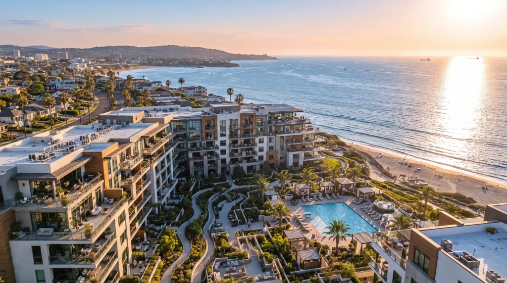
Why a community’s layout only makes sense from the air
Here is the core value, and it is specific to multi-building properties. When a community spreads across several structures and acres, ground photos fragment it into disconnected pieces. A renter sees a photo of a pool, a photo of a building, and a photo of a gym and cannot assemble them into a place. An aerial stitches those fragments into a coherent whole.
From above, the relationships become obvious. A prospect can see how close their building would sit to the pool, whether parking is a short walk or a long one, how much green space threads through the property, and where the quiet corners are versus the busy ones. This sense of internal geography, the adjacency of amenities to homes, is something renters weigh heavily and can rarely judge from a gallery of ground shots. A single well-composed aerial communicates the community’s wayfinding in a way that paragraphs of description cannot.
Location legibility matters just as much. An aerial view shows a community’s place in its surroundings, the adjacent parks, the nearby retail, the freeway access, and the distance to the coast—context that shapes a renter’s decision and that a camera at street level simply cannot reach.
The kinds of aerial shots that sell an apartment community
Aerial photography is not one shot repeated; it is a small vocabulary of perspectives, each doing a different job. A thoughtful session captures several.
- The top-down site view. A near-vertical shot looking straight down, which reads almost like a site map. This is the frame that shows the community’s full layout, the arrangement of buildings, amenities, and parking, in one clean image.
- The oblique hero shot. A dramatic angled view from altitude that captures the property’s scale and character while keeping the skyline or landscape in the background. This is usually the headline aerial in a listing.
- The amenity overview. A framed elevated shot of the pool deck, courtyard, or rooftop lounge that shows the amenity in its full context rather than the tight crop a ground photo forces.
- The flythrough. Aerial video that glides over and around the property, revealing the site in motion. A cinematic apartment video built around a drone flythrough gives prospects a dynamic feel for the community that stills cannot match.
- The twilight aerial. Captured at dusk when the pool glows, pathway lighting comes alive, and the community looks its most inviting against a colored sky. These are among the most striking images a property can own.
- The annotated aerial. A top-down shot with amenities and buildings labeled, turning the image into a practical orientation tool for prospects and leasing teams alike.
Matching the mix of shots to the property is part of what separates a considered aerial session from a few generic overhead snaps.
Selling a San Diego location from the air
San Diego’s geography is a genuine leasing asset, and aerials are how you cash it in. Proximity to the coast, the bays, the canyons and mesas, the trolley lines, and the freeway network are exactly the things renters prioritize, and they are exactly the things a drone can show that a ground camera cannot.
An aerial can frame a community with the Pacific glinting in the distance, place it against the green of a canyon rim, or show its walkable adjacency to a village of shops and restaurants. For a renter weighing where in the county to live, that visible context is persuasive in a way a written “close to the beach” never is. Coastal light works in the property’s favor here too, giving San Diego aerials a clarity and color that make the location look as appealing as it feels. Capturing that relationship between the community and its setting is one of the strongest arguments for shooting a San Diego property from above.
Beyond leasing: aerials for owners, investors, and development
Apartment aerials are not only a marketing tool for prospective renters. Ownership groups and developers put the same imagery to work in several other ways.
For acquisitions and dispositions, a strong aerial set communicates a property’s scale and position to prospective buyers and investors far more effectively than a spreadsheet, anchoring an offering memorandum with a real sense of the asset. For portfolio owners, consistent aerial documentation across properties creates a uniform, professional visual record. For value-add projects, before-and-after aerials capture the transformation of a renovated community, a compelling proof point for investors and future marketing alike. And for developments still taking shape, periodic aerials track a project’s evolution over time for stakeholders and lenders.
Viewed this way, an aerial session produces an asset that serves leasing, investment, and reporting at once, which is part of why owners of larger communities treat it as standard rather than optional.
Aerial stills or aerial video: which does your community need?
Both formats have distinct roles, and most communities benefit from a blend rather than one or the other. Aerial stills are the practical workhorses: they populate listing galleries, anchor an offering document, and serve as the top-down site view or oblique hero that renters study when sizing up a property. They load fast, read instantly, and never demand a viewer’s sustained attention.
Aerial video earns its place where motion adds meaning. A flythrough that sweeps across the rooftops and orbits the pool deck conveys the flow and connectivity of a large site in a way a single frame cannot, and it thrives on social platforms and property websites where movement holds a scroller’s eye. The trade-off is production: video takes more flight planning, more editing, and more budget than stills.
A sensible approach for most San Diego communities is a full set of stills for the listing and documentation, plus one short aerial video reveal for social and the website homepage. That pairing covers the practical need and the marketing hook without overspending on either.
The rules for flying over San Diego apartment communities
Flying a drone commercially is regulated, and San Diego’s skies are busier than most. The county sits under a dense patchwork of controlled airspace shaped by San Diego International Airport near downtown, MCAS Miramar, Montgomery-Gibbs Executive Airport, and the naval airfields around the bay, plus coastal considerations along the shoreline. A great many apartment communities fall within airspace that requires authorization before a drone can legally launch.
A compliant operator works within the framework the FAA sets: a Part 107 Remote Pilot Certificate, flights kept within visual line of sight and generally below 400 feet, and digital airspace authorization, typically through the LAANC system, in controlled zones. Understanding which authorizations a given address requires and where flight is restricted outright is genuine local expertise that takes experience in San Diego’s specific airspace to develop. There is also a courtesy dimension unique to occupied communities: a considerate pilot frames the property while respecting residents’ privacy, avoiding intrusive angles into windows and balconies. Hiring a licensed, insured, locally fluent operator is what keeps a shoot legal, safe, and on schedule.
How to choose an apartment/aerial photographer
When you are hiring for aerial work specifically, a few criteria matter most:
- San Diego airspace knowledge. A pilot fluent in the county’s controlled zones can secure the right authorizations and plan a flight that actually happens on the scheduled day.
- FAA Part 107 certification and insurance. Non-negotiable for commercial aerial work over a community and a marker of a serious operation.
- A multifamily aerial portfolio. Look for real apartment and community aerials, top-down layouts, oblique heroes, and amenity overviews, not just single-home flyovers.
- Aerial video capability. If you want a flythrough or a reveal for social media, confirm the operator shoots and edits smooth aerial motion, not just stills.
- Post-production quality. Raw aerials need skilled editing to reach their potential; ask to see finished, color-graded work.
- Coordination for larger sites. A community shoot involves scheduling, site review, and access; a professional handles that logistics smoothly.
The right apartment aerial photographer combines a pilot’s airspace fluency with a photographer’s eye and can deliver both the still and the motion content a community’s marketing calls for.
How PropertyVidPro captures San Diego communities from above
PropertyVidPro focuses its aerial work specifically on apartment and multifamily marketing across San Diego, capturing rooftops, pool decks, parking structures, landscaping, and the surrounding neighborhood so a community’s full scale and setting come through in a single set of images. The team pairs airspace fluency with real estate photography experience, flying FAA-compliant, insured operations and shaping each session around the property’s layout and its San Diego surroundings.
Aerial projects also slot neatly alongside the community’s other visuals, connecting with ground-level apartment photography, broader multifamily photography, and video, so a property’s marketing reads as one polished body of work rather than a patchwork. Scheduling, site review, and image delivery are coordinated to keep a launch on track. You can see the full scope of apartment drone photography in San Diego page.
Frequently asked questions
What is apartment drone photography?
It is aerial imaging of an apartment community and its surroundings, shot from an elevated vantage. Rather than a single unit, it captures the whole site, rooftops, amenities, parking, landscaping, and the neighborhood, giving renters a complete spatial picture of the property.
Why do apartment communities need aerial photos?
Large, multi-building communities are hard to understand from ground photos. Aerials reveal the site’s layout, the adjacency of amenities to homes, the amount of green space, and the location’s context, information renters weigh heavily and cannot get from street-level images.
What kinds of aerial shots should an apartment community get?
A useful mix includes a top-down site view showing the full layout, an oblique hero shot for scale and drama, amenity overviews, a video flythrough, twilight aerials of the lit community, and annotated aerials that label buildings and amenities.
Do you need a license to fly a drone over an apartment community in San Diego, CA?
Yes. Commercial drone work requires an FAA Part 107 certificate, flights within visual line of sight and generally below 400 feet, and airspace authorization through LAANC in San Diego’s many controlled zones near the airport, Miramar, and the bay.
How does aerial photography help sell a San Diego location?
Drones can show a community’s proximity to the coast, canyons, transit, and local retail, San Diego’s geographic selling points, in a single frame. That visible context is far more persuasive to renters than written descriptions of nearby features.
How do owners use apartment aerials beyond leasing?
Ownership groups use aerials for acquisition and disposition marketing, consistent portfolio documentation, before-and-after records of value-add renovations, and tracking developments over time for investors and lenders.
Ready to show your San Diego community from above?
If you own or manage an apartment community and want aerials that reveal its full scale, layout, and location, explore apartment drone photography in San Diego CA, or call PropertyVidPro at (909) 282-8546. Book a free consultation, and give your property the elevated perspective that ground photos can never capture.